From Regout to Céramique
A route of its own past what is left of the pottery: the factory gate of De Sphinx, a passage with thirty thousand tiles, tile panels on a facade and in the station hall, and the two halls of the Société Céramique.
Forty-five pearls between the Vrijthof and Wyck: a cannonball in a facade with a date that can't be right, the oldest city gate in the Netherlands, a Roman bathhouse in the paving, and seven places where you lay an old print or photo over today's city.
The routes
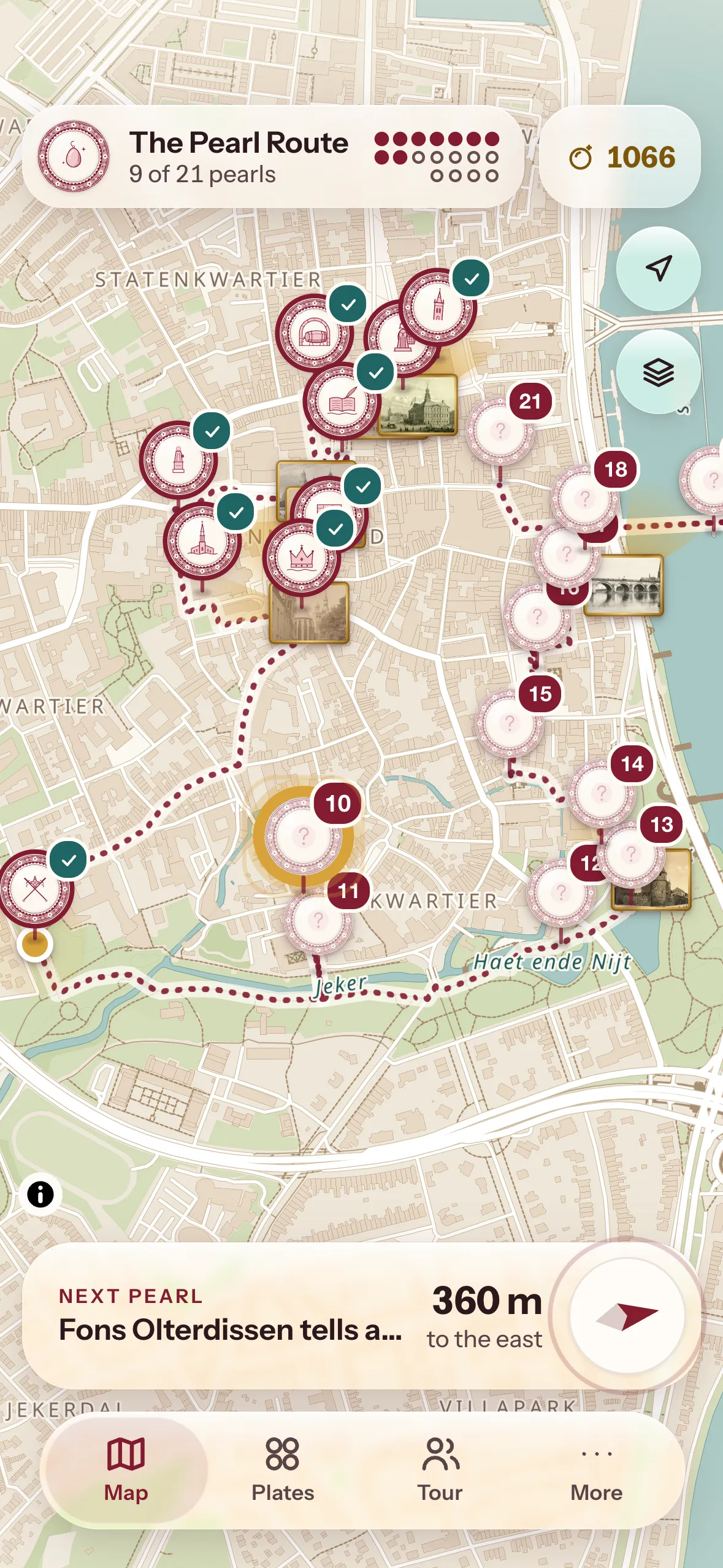
A route has a set order along real streets, with time to look and read. Would you rather wander on your own? Choose All pearls, and the compass keeps pointing to the nearest one you haven't found yet.
21 pearls, about 3 hours 15 minutes
The grand loop through Maastricht
From the Markt past the Vrijthof and its churches to d'Artagnan, the ramparts of the Jekerkwartier and the Helpoort, then past the Star of the Sea and the Mestreechter Geis, over the Sint-Servaasbrug to Wyck, and back to the Dinghuis.
Start: Markt, by the Mooswief
10 pearls, about 1 hour 30 minutes
Maastricht in an hour and a half
The well-known places, each with a detail you would otherwise walk past: the Mooswief, the town hall, the bookshop in a church, Servatius and his portal, the house of Charles V, the Helpoort, the Star of the Sea, the Geis and the old bridge.
Start: Markt, by the Mooswief
10 pearls, about 1 hour 40 minutes
Along the fortifications of a besieged city
From the Hoofdwacht (main guardhouse), where the watch began every day, to the spot where d'Artagnan fell, then along the city wall, the rondels and the gates of the Jekerkwartier, and over the Hoge Brug footbridge to the walls of Wyck.
Start: Vrijthof, by the Hoofdwacht
8 pearls, about 1 hour 40 minutes
Where Maastricht made plates, tiles and washbasins
From Petrus Regout's factory gate and the tile passage of De Sphinx, past the Bassin (inner harbour) and the old bridge to Wyck, along tile panels on a facade and in the station hall, to the two halls that remain of the Société Céramique.
Start: Boschstraat, by the gate of De Sphinx
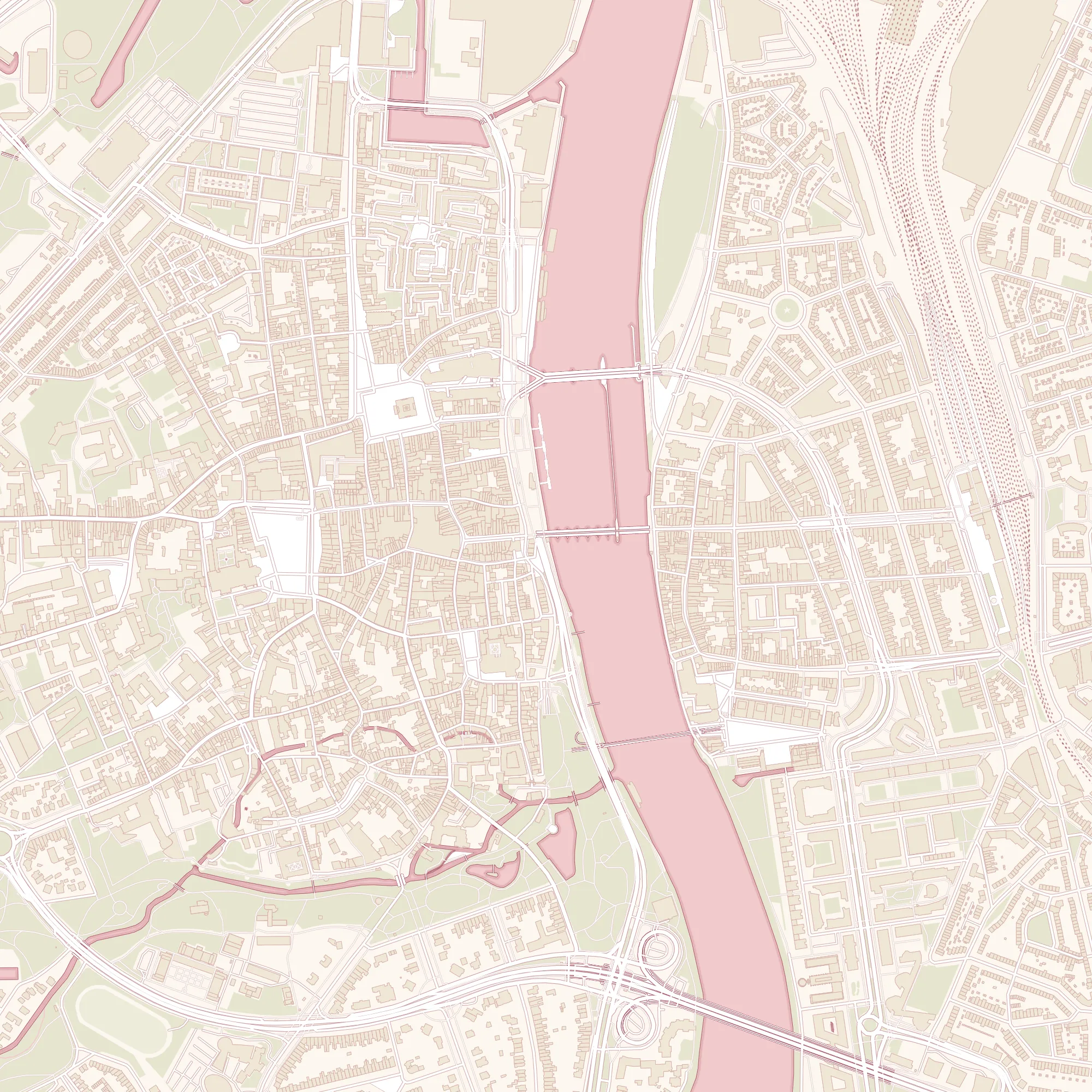
Map: © OpenStreetMap contributors, OpenFreeMap, OpenMapTiles.
All pearls
Tap a pearl for its riddle. You only get the story and the spotting question once you're standing there.
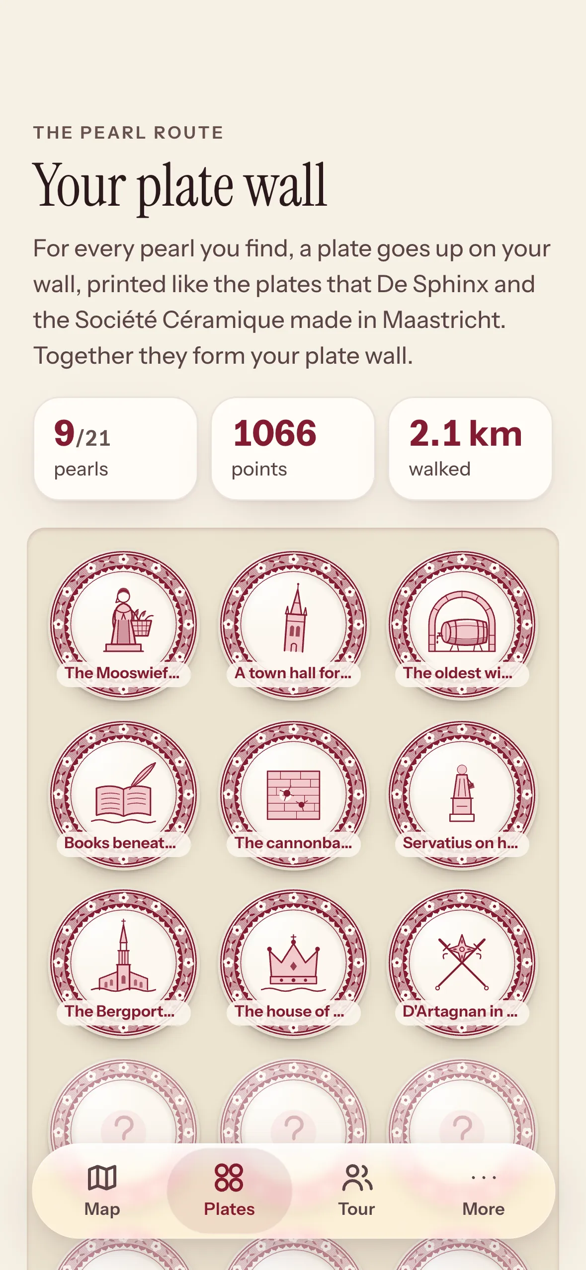
Your plate wall
For more than a century, Petrus Regout's De Sphinx and the Société Céramique made plates here for half the world. That's why in Maastricht a right answer earns you a plate in their style: a red rim full of flowers and tendrils, and in the centre the pearl's motif.
A route of its own past what is left of the pottery: the factory gate of De Sphinx, a passage with thirty thousand tiles, tile panels on a facade and in the station hall, and the two halls of the Société Céramique.
From the Hoofdwacht past the spot where d'Artagnan fell to the rondels of the Jekerkwartier and the Helpoort, almost eight hundred years old.
Just off the train? Say where you need to go, and from Maastricht station the app plans a walk with a ten, twenty or forty-minute detour past pearls.
One tap and the app walks with you: the map turns with the way you're facing and a voice calls out the turns, so your phone can stay in your pocket.
Maastricht in 1649
Joan Blaeu drew Maastricht in 1649, between two sieges: that of Frederick Henry in 1632 and that of 1673, in which d'Artagnan fell. In the app his map lies over today's city, bent into place at fifty points, so that his streets fall on yours to within about five metres. Go on, move the glass over the city.
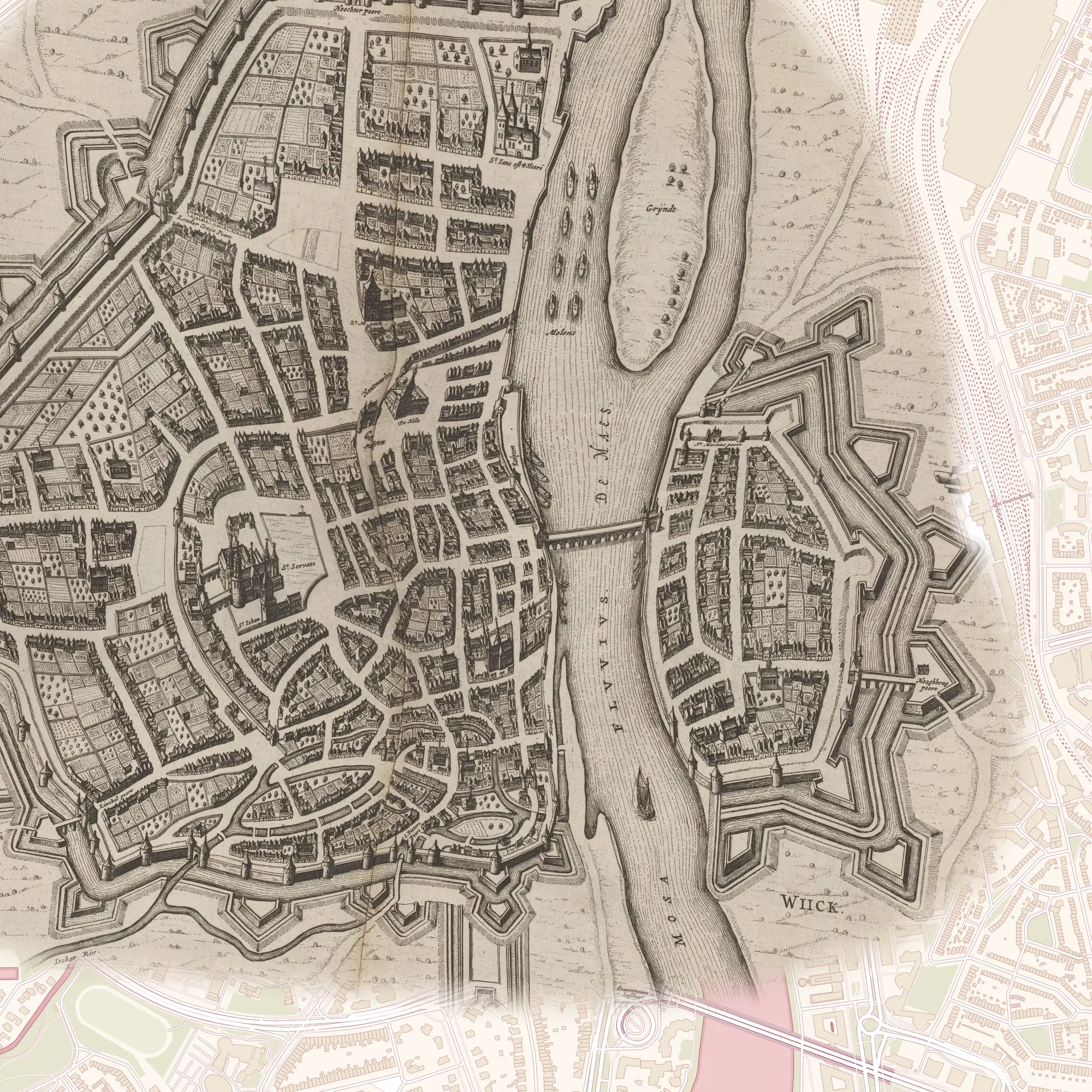
Today's map: © OpenStreetMap contributors, OpenFreeMap. Joan Blaeu, Maastricht, 1649: Rijksmuseum, public domain.
Then and now
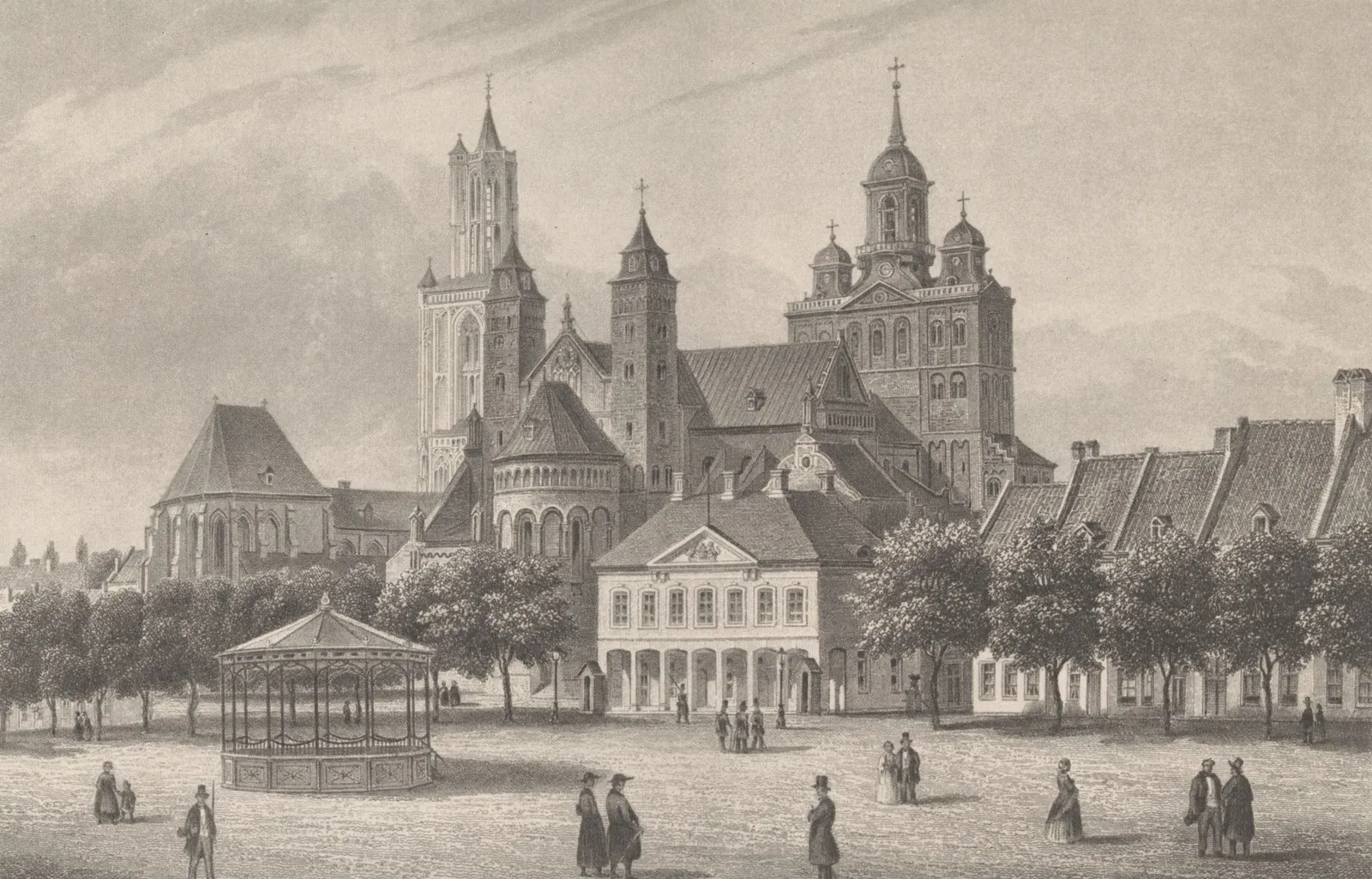
In the app, each image hangs in a little gilded frame on the map, with a fan that shows which way it looks. Stand there and face the same way, and through your camera it hangs at full size over today's city.
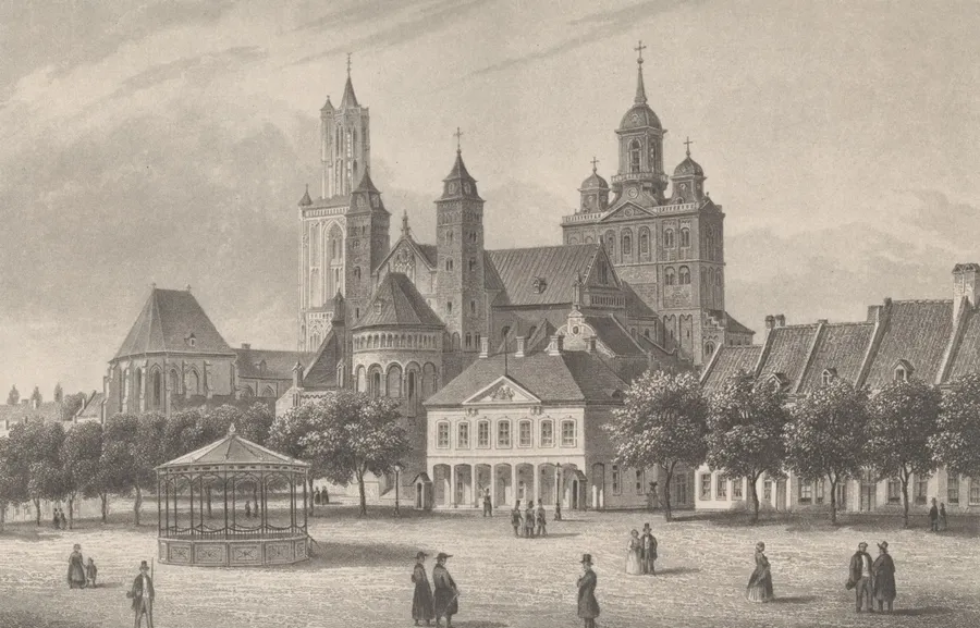
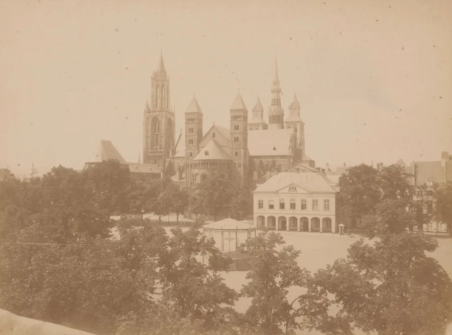
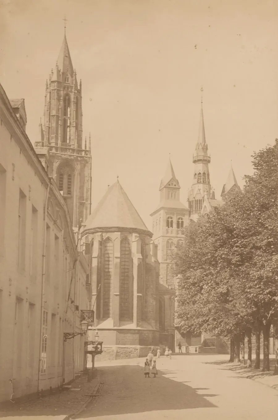
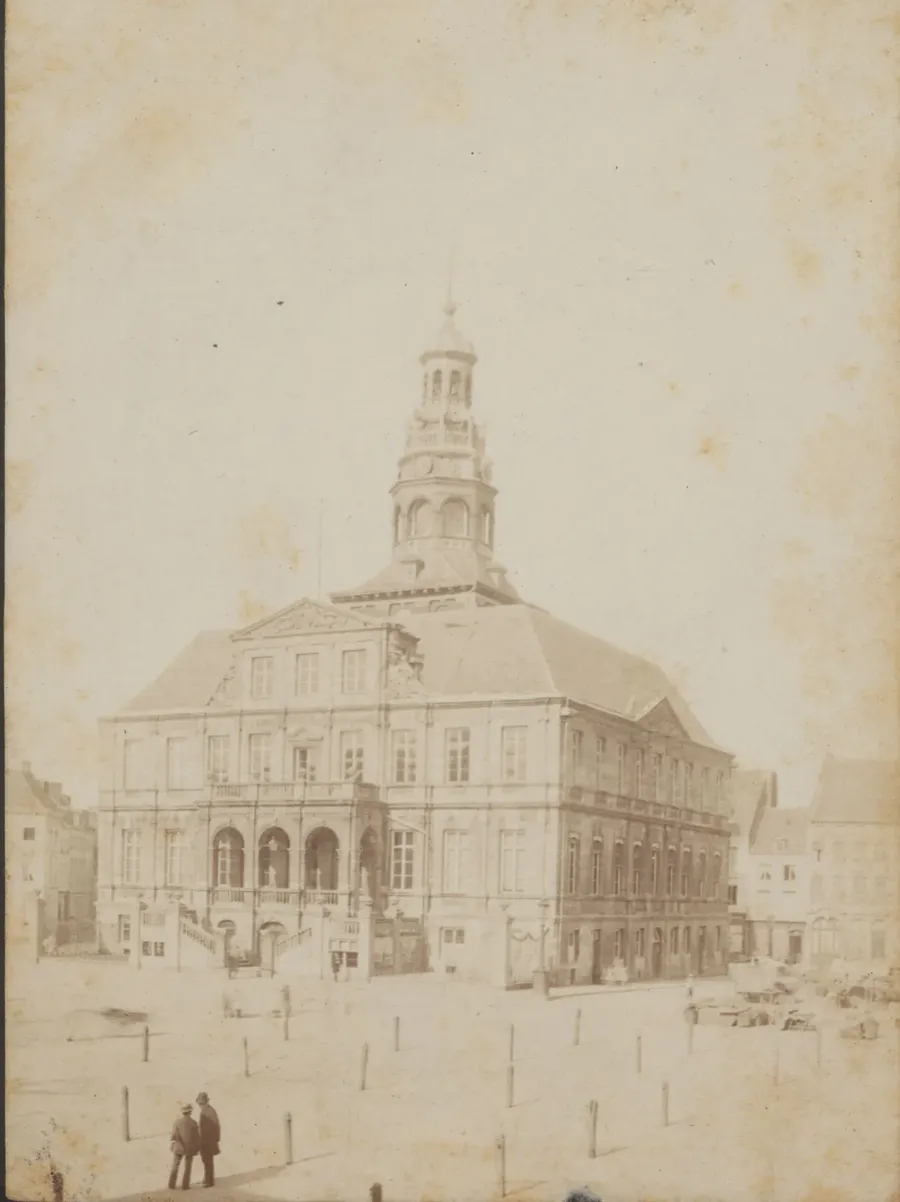
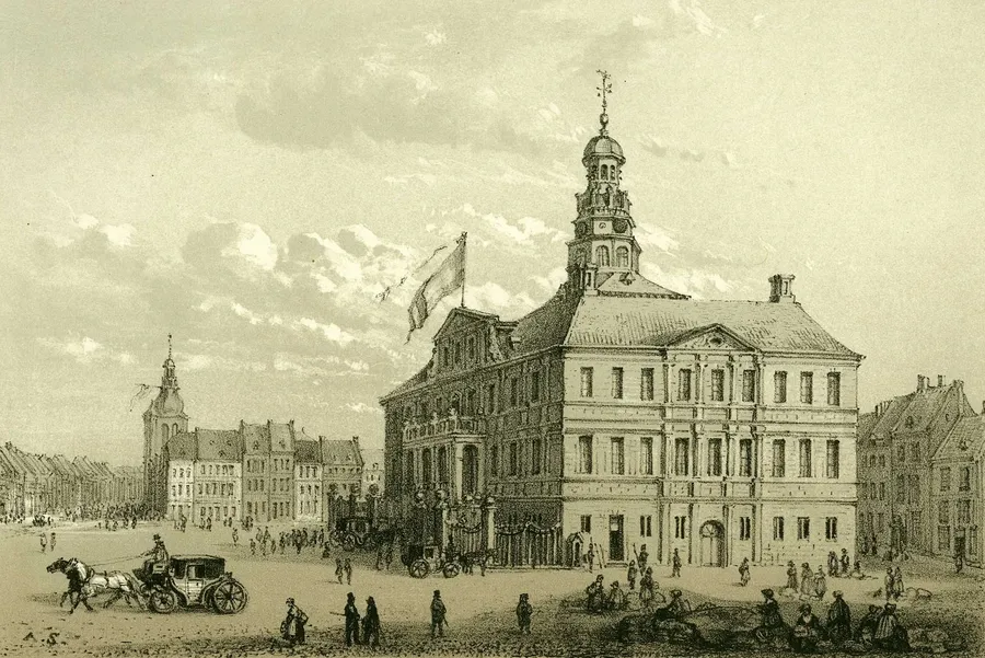
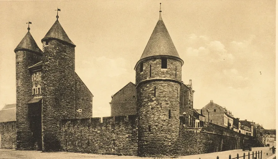
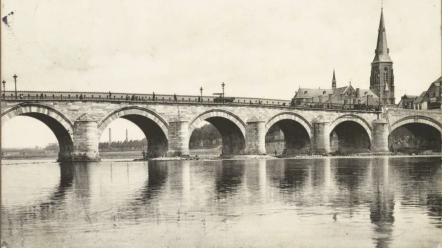
All images are public domain or CC0; the app gives the source with each one.
Trial period
Pearls of Maastricht is in its trial period: all 45 pearls, the four routes, Then and now and Maastricht in 1649 are free, no account needed. What you find stays saved on your phone.
Questions
No. Pearls of Maastricht runs in your phone's browser: scan the code or open the link and you're playing. Add it to your home screen and it opens like a normal app, and works without signal too.
Yes, with an empty plate wall. Each city has its own address, and your phone saves your finds per address. That way your Delft tile panel loses nothing when you start in Maastricht.
From an hour and a half (The highlights) to over three hours (The Pearl Route), including time to look and read. You can always stop and carry on later: your finds stay saved on your phone.
Wherever you like. The Pearl Route and The highlights start on the Markt by the Mooswief, Ramparts and gates on the Vrijthof by the Hoofdwacht, and From Regout to Céramique in the Boschstraat by the gate of De Sphinx. Coming by train? Choose Walk to your hotel or appointment via pearls: the app plans a walk from Maastricht station.
Mostly. Once you've opened the app, the map of the old town, the stories and the images are on your phone. Only the walking route in Show me the way needs signal; the compass points the way without it.
It stays on your phone. Only for the walking route does your position go to the route planner, and in a tour the game leader sees where the teams are. A tour is deleted three days after it ends. More in the privacy policy.
Yes. From about eight, children play along well, ideally with an adult on one phone. The wild boar above a little gate, d'Artagnan in the park and the boy with his dog in the Stokstraat are often their favourite part; you read the stories together.
Yes. The app speaks English, Dutch, German, French, Spanish, Portuguese, Italian, Chinese and Japanese, and follows the language of your phone. You can switch on the welcome screen or under More.
Any recent iPhone or Android phone, in Safari or Chrome. For Then and now and the camera view you need a camera and a compass; almost every phone has both.
Scan the code with your phone, or tap the button if it's already in your hand. Free to play for now, no account needed.